Hurricane forecasts have improved dramatically, saving lives, but federal cuts threaten to stretch N
A hurricane scientist explains the technology forecasters rely on to keep people safe and help communities all along the Atlantic coast know when to evacuate.

The 2026 Atlantic hurricane season starts June 1, and while a developing El Niño might result in a tamer season than in the past few years, all it takes is one big storm hitting a populated area to make it a bad hurricane season.
Every year, Americans rely on accurate forecasts when hurricanes might be developing to know when to stock up on supplies, prepare for power outages or evacuate.
Those forecasts have improved dramatically in recent decades, but the improvements can’t be taken for granted. Over the past year, federal funding cuts and job losses in the very programs that are helping make Americans safer from extreme weather threaten to stall progress and stretch forecasting resources to the breaking point.

I am an atmospheric scientist whose research focuses on hurricanes, including how and why they intensify or weaken. I also work with scientists at the National Atmospheric and Oceanic Administration, NOAA, to analyze observations collected by reconnaissance aircraft and evaluate computer model forecasts of hurricanes.
Here’s what forecasters rely on during hurricane season and why investing in science, forecasting technologies and the people who run them matters.
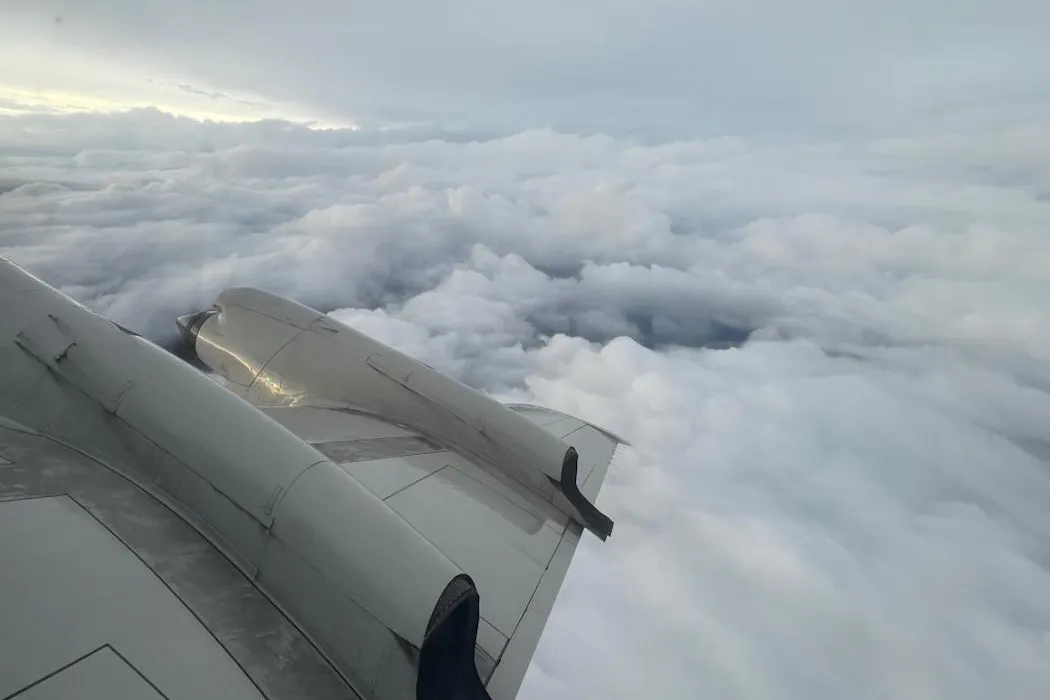
Flying through hurricanes
To have the best chance of an accurate hurricane forecast, computer models and meteorologists need to know about the location, intensity and structure of a hurricane, along with the environment that surrounds it. Satellites are crucial for tracking storms from above, but many details can be collected only inside the storm, where satellites can’t see.
That’s why NOAA relies on “hurricane hunters” – a group of skilled pilots and scientists who fly through storms all season long to collect storm data, which is quickly transmitted to forecasters and computer models.


When storms are developing, the U.S. Air Force Reserve and NOAA conduct several hurricane hunter flights per day to provide the most up-to-date storm information. During these missions, the crews often fly directly into the storm, through screaming winds and heavy rain, to release instrument packages called dropsondes.
The dropsonde is a feat of science and engineering, able to accurately measure the temperature, humidity, wind and pressure in hostile conditions. This data is radioed back to the aircraft. From there, it is processed and transmitted to NOAA, where forecasters analyze it and computer models use it to initialize forecasts.
I and many hurricane scientists have used dropsonde data collected over the years to build a better understanding of how hurricanes behave. A recent study showed that computer model forecasts of hurricane tracks were up to 24% more accurate when they included dropsonde data than those that didn’t.
Simulating hurricanes
A big reason hurricane forecasts have gotten better has been federal investments in computer models that can simulate these storms.
In 2008 the U.S. government funded the NOAA Hurricane Forecast Improvement Project, leading to substantial advancements in computer modeling and forecast accuracy. Computer models got better at incorporating the observations gathered by aircraft, showing air movements and rain bands in greater detail.

The flagship NOAA hurricane model is now the Hurricane Analysis and Forecast System, which does a better job of predicting rapid intensification, among other things, than its predecessors.
When storms rapidly intensify, as several have done in recent years, they can pose an acute risk to coastal communities. More accurate forecasts give people and communities better information to decide how to prepare and when they need to evacuate. Improvements since 2007 have resulted in an estimated US$2 billion in savings per hurricane landfall and many lives saved.
That’s a huge return on investment. In 2024, NOAA’s entire budget was $6.7 billion.
Keeping an eye on the storms ahead
There are some exciting developments ahead in hurricane observations and modeling.
NOAA in 2024 ordered two new aircraft, expected to be delivered by 2030, to begin replacing its aging hurricane hunter fleet so fights and their data collection can continue.
Private companies working with NOAA have deployed and tested autonomous drones – both in the air and sail drones on the ocean surface – that can collect data in areas where quality observations are hard to get.
Additionally, artificial intelligence weather models have emerged, such as Google DeepMind, which made a big splash as the most accurate forecast model of the 2025 hurricane season.
Some lingering dark clouds
Despite these promising developments, a different storm is eroding the bedrock upon which the national weather forecast enterprise sits.
Cuts in funding and staffing have stressed NOAA’s ability to collect critical observations. Last year, retired NOAA scientists volunteered to staff hurricane hunter reconnaissance flights so the missions could still be flown.

The Trump administration proposed cutting NOAA’s budget by more than a quarter, including dismantling its Office of Oceanic and Atmospheric Research. Congress rejected many of the administration’s proposed budget cuts, ultimately approving a $6.1 billion budget in March 2026, still down from the previous budget.
The National Center for Atmospheric Research, which led the development of computer models and dropsonde technology, has also been targeted by the Trump administration to be dismantled. The American Meteorological Society warns this decision “will harm meteorological research and innovation in the United States with severe consequences to current and future efforts of the weather enterprise to protect life, property, and the nation’s economy.”
I worry about the funding and staff cuts stressing systems that keep scientific progress marching forward and warn Americans about hazardous weather. Losing staff and support raises the risk of critical failures, such as delayed severe weather warnings and broken equipment causing new blind spots when storms threaten. In the long run, failing to invest risks stagnation or even reversing the hard-fought progress the U.S. has made in advancing weather prediction.
With coastal populations and development expanding over the past few decades, and storms becoming stronger, the vulnerability of the U.S. to costly, damaging hurricanes has increased dramatically. It is more important than ever that public investment in hurricane science and forecasting continue.
Brian Tang receives funding from the National Science Foundation, the National Aeronautics and Space Administration, and the Center for Western Weather and Water Extremes. He has research collaborations with the National Oceanic and Atmospheric Administration's Hurricane Research Division. He is a member of the American Meteorological Society.
Read These Next
‘Sanctuary people’ redefine what it means to protect immigrants in uncertain times
Many faith groups supporting immigrants root their mission in the idea of ‘accompaniment,’ which…
5 lessons from 20 years of climate surveys: Political party matters, but it doesn’t explain everythi
Why would a young Republican back solar but reject a carbon tax? Twenty years of survey data shows climate…

I’m a Philly neonatologist, and every time I discharge a baby from the NICU, I worry about the air t
Even small increases in air pollution can increase the risk of serious respiratory illnesses for preterm…