Water is the other US-Mexico border crisis, and the supply crunch is getting worse
Immigration isn’t the only hot-button issue along the US-Mexico border. There’s also a growing water shortage that’s affecting farmers, businesses and cities on both sides.

Immigration and border security will be the likely focus of U.S.-Mexico relations under the new Trump administration. But there also is a growing water crisis along the U.S.–Mexico border that affects tens of millions of people on both sides, and it can only be managed if the two governments work together.
Climate change is shrinking surface and groundwater supplies in the southwestern U.S. Higher air temperatures are increasing evaporation rates from rivers and streams and intensifying drought. Mexico is also experiencing multiyear droughts and heat waves.
Growing water use is already overtaxing limited supplies from nearly all of the region’s cross-border rivers, streams and aquifers. Many of these sources are contaminated with agricultural pollutants, untreated waste and other substances, further reducing the usability of available water.
As Texas-based scholars who study the legal and scientific aspects of water policy, we know that communities, farms and businesses in both countries rely on these scarce water supplies. In our view, water conditions on the border have changed so much that the current legal framework for managing them is inadequate.
Unless both nations recognize this fact, we believe that water problems in the region are likely to worsen, and supplies may never recover to levels seen as recently as the 1950s. Although the U.S. and Mexico have moved to address these concerns by updating the 1944 water treaty, these steps are not long-term solutions.

Growing demand, shrinking supply
The U.S.-Mexico border region is mostly arid, with water coming from a few rivers and an unknown amount of groundwater. The main rivers that cross the border are the Colorado and the Rio Grande – two of the most water-stressed systems in the world.
The Colorado River provides water to more than 44 million people, including seven U.S. and two Mexican states, 29 Indian tribes and 5.5 million acres of farmland. Only about 10% of its total flow reaches Mexico. The river once emptied into the Gulf of California, but now so much water is withdrawn along its course that since the 1960s it typically peters out in the desert.
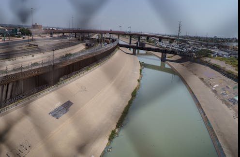
The Rio Grande supplies water to roughly 15 million people, including 22 Indian tribes, three U.S. and four Mexican states and 2.8 million irrigated acres. It forms the 1,250-mile (2,000-kilometer) Texas-Mexico border, winding from El Paso in the west to the Gulf of Mexico in the east.

Other rivers that cross the border include the Tijuana, San Pedro, Santa Cruz, New and Gila. These are all significantly smaller and have less economic impact than the Colorado and the Rio Grande.
At least 28 aquifers – underground rock formations that contain water – also traverse the border. With a few exceptions, very little information on these shared resources exists. One thing that is known is that many of them are severely overtapped and contaminated.
Nonetheless, reliance on aquifers is growing as surface water supplies dwindle. Some 80% of groundwater used in the border region goes to agriculture. The rest is used by farmers and industries, such as automotive and appliance manufacturers.
Over 10 million people in 30 cities and communities throughout the border region rely on groundwater for domestic use. Many communities, including Ciudad Juarez; the sister cities of Nogales in both Arizona and Sonora; and the sister cities of Columbus in New Mexico and Puerto Palomas in Chihuahua, get all or most of their fresh water from these aquifers.
A booming region
About 30 million people live within 100 miles (160 kilometers) of the border on both sides. Over the next 30 years, that figure is expected to double.
Municipal and industrial water use throughout the region is also expected to increase. In Texas’ lower Rio Grande Valley, municipal use alone could more than double by 2040.
At the same time, as climate change continues to worsen, scientists project that snowmelt will decrease and evaporation rates will increase. The Colorado River’s baseflow – the portion of its volume that comes from groundwater, rather than from rain and snow – may decline by nearly 30% in the next 30 years.
Precipitation patterns across the region are projected to be uncertain and erratic for the foreseeable future. This trend will fuel more extreme weather events, such as droughts and floods, which could cause widespread harm to crops, industrial activity, human health and the environment.
Further stress comes from growth and development. Both the Colorado River and Rio Grande are tainted by pollutants from agricultural, municipal and industrial sources. Cities on both sides of the border, especially on the Mexican side, have a long history of dumping untreated sewage into the Rio Grande. Of the 55 water treatment plants located along the border, 80% reported ongoing maintenance, capacity and operating problems as of 2019.
Drought across the border region is already stoking domestic and bilateral tensions. Competing water users are struggling to meet their needs, and the U.S. and Mexico are straining to comply with treaty obligations for sharing water.
Cross-border water politics
Mexico and the United States manage water allocations in the border region mainly under two treaties: a 1906 agreement focused on the Upper Rio Grande Basin and a 1944 treaty covering the Colorado River and Lower Rio Grande.
Under the 1906 treaty, the U.S. is obligated to deliver 60,000 acre-feet of water to Mexico where the Rio Grande reaches the border. This target may be reduced during droughts, which have occurred frequently in recent decades. An acre-foot is enough water to flood an acre of land 1 foot deep – about 325,000 gallons (1.2 million liters).
Allocations under the 1944 treaty are more complicated. The U.S. is required to deliver 1.5 million acre-feet of Colorado River water to Mexico at the border – but as with the 1906 treaty, reductions are allowed in cases of extraordinary drought.
Until the mid-2010s, the U.S. met its full obligation each year. Since then, however, regional drought and climate change have severely reduced the Colorado River’s flow, requiring substantial allocation reductions for both the U.S. and Mexico.
In 2025, states in the U.S. section of the lower Colorado River basin will see a reduction of over 1 million acre-feet from prior years. Mexico’s allocation will decline by approximately 280,500 acre-feet under the 1944 treaty.
This agreement provides each nation with designated fractions of flows from the Lower Rio Grande and specific tributaries. Regardless of water availability or climatic conditions, Mexico also is required to deliver to the U.S. a minimum of 1,750,000 acre-feet of water from six named tributaries, averaged over five-year cycles. If Mexico falls short in one cycle, it can make up the deficit in the next five-year cycle, but cannot delay repayment further.
Since the 1990s, extraordinary droughts have caused Mexico to miss its delivery obligations three times. Although Mexico repaid its water debts in subsequent cycles, these shortfalls raised diplomatic tensions that led to last-minute negotiations and large-scale water transfers from Mexico to the U.S.
Mexican farmers in Lower Rio Grande irrigation districts who had to shoulder these cuts felt betrayed. In 2020, they protested, confronting federal soldiers and temporarily seizing control of a dam.
U.S. President Donald Trump and Mexican President Claudia Scheinbaum clearly appreciate the political and economic importance of the border region. But if water scarcity worsens, it could supplant other border priorities.
In our view, the best way to prevent this would be for the two countries to recognize that conditions are deteriorating and update the existing cross-border governance regime so that it reflects today’s new water realities.
Gabriel Eckstein is affiliated with the Permanent Forum on Binational Waters, International Association for Water Law, and International Water Resources Association.
Rosario Sanchez receives funding from the USGS under the Transboundary Aquifer Assessment Program Act. She is affiliated with Texas A&M University and the non-profit as a volunteer to the Permanent Forum of Binational Waters, the International Association of Hydrogeologists, and the International Water Resources Association.
Read These Next

Cyclosporiasis sickens some people worse – why your diarrhea could be more explosive than others
Explosive diarrhea has been spreading across the US, and the parasite that causes the disease has already…
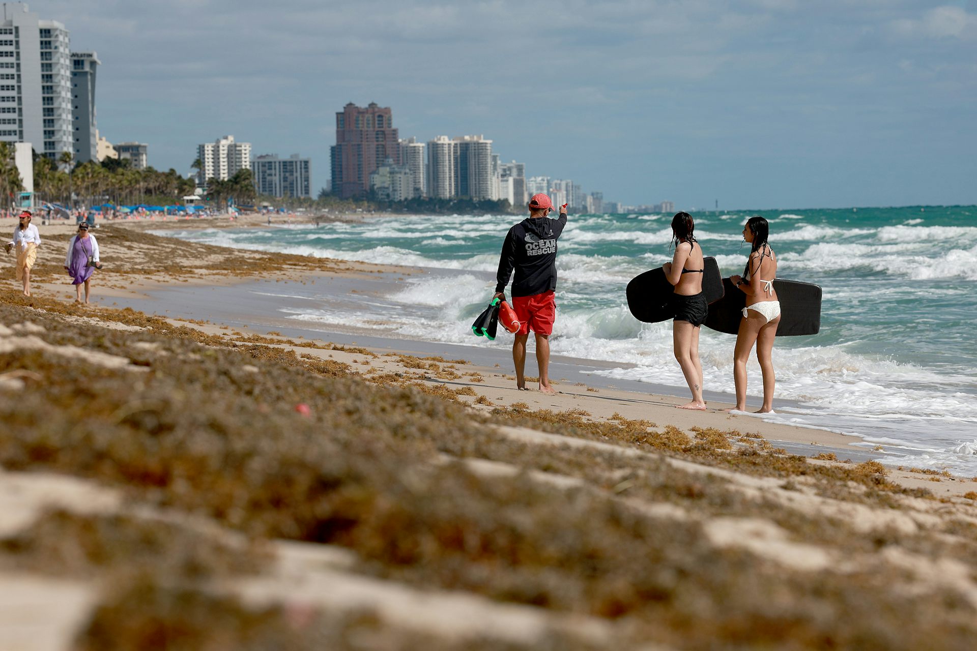
Sargassum, the smelly nemesis of beach vacations, has become a self-sustaining disaster that will ke
Communities and entrepreneurs are experimenting with ways to turn this nuisance into a valuable resource.

Affordable housing often costs more to build than market-rate housing – Colorado is closing the gap
Lower land costs and new statewide housing reforms have made Colorado an outlier.