The US government might charge for satellite data again – here's why that would be a big mistake
Since 2008, Landsat data has been free for the world to use, spurring new applications and scientific research. But that door could soon slam shut.
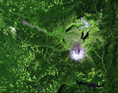
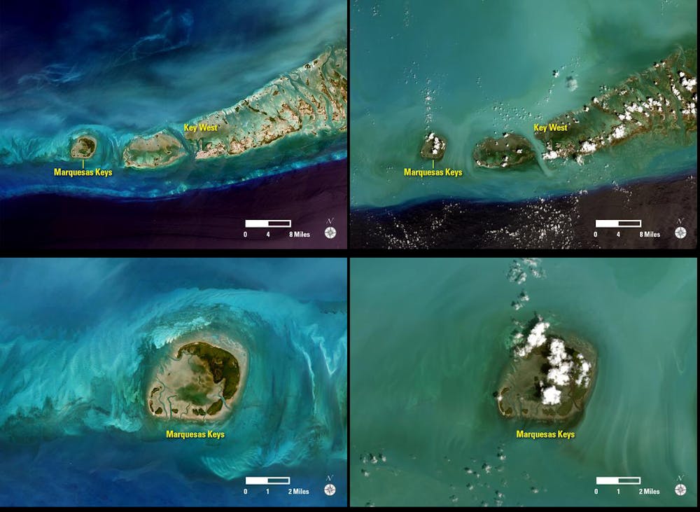
Landsat is one of the most important U.S. satellite systems. Since the program’s launch in 1972, Landsat satellites have provided the longest-running terrestrial satellite record and collected more than 5.6 million images.
For a long time, the U.S. government charged a fee for every Landsat image. But this changed on Oct. 1, 2008, when the U.S. Geological Survey opened the Landsat archive and made it free for everyone to use.
This open data policy has led to a dramatic increase in the use of Landsat data. Studies have used Landsat data to map global forest loss, surface water extent, human settlements and land cover, among other features.
However, the free and open Landsat data policy is now under scrutiny. An April 2018 news report revealed that the Department of the Interior was considering putting a price on Landsat data again. The decision will come sometime this year.
This potential policy change is concerning. The USGS-NASA Landsat Science Team, of which I am a member, published a study on Feb. 27 highlighting the major benefits of Landsat’s free data policy. For the Landsat program to remain successful, free and open data is the key.
1. Encouraged more data use and research
Before the free data policy, the USGS and private sector sold at most 3,000 Landsat images per month. At the time, a single Landsat image cost approximately US$600.
In the first full year of free data policy, users downloaded more than 1 million images. That number has shot up over time, with more than 20 million images downloaded in 2017.
The number of Landsat-related scientific publications also increased rapidly. More than four times as many scientific publications came out in 2017 as did in 2005.
The free data policy has opened the doors for new research. The use of Landsat data to track landscape changes over time increased rapidly after the new policy, which has advanced remote sensing science in a variety of ways. With the denser Landsat data, scientists can create better land cover maps; more accurately detect landscape changes; and map natural resources in near real-time.
Landsat data is also archived by several commercial cloud computing services, such as Google Earth Engine and Amazon Web Services. This allows less-established institutions to use Landsat data and lets people share the code they used to analyze images more easily. Charging a fee for Landsat data would jeopardize the continued availability of Landsat data in private sector archives.
2. Created economic benefits
In a 2014 paper, the National Geospatial Advisory Committee analyzed 16 economic sectors – such as water consumption, wildfire mapping and agriculture – in which Landsat data has lead to substantial productivity savings.
Just for the year of 2011, the estimated economic benefit of Landsat data was more than $1.7 billion for U.S. users and $400 million for users outside the U.S.
For example, the U.S. Department of Agriculture Risk Management Agency provides crop insurance to U.S. farmers. More than 1.2 million policies are issued every year. One in five policies are issued in areas subject to flooding, leading to higher premiums.
Before Landsat data was used for mapping crop flood zones, the flooding areas were very broad, causing many farmers with little potential for flooding to pay a lot more. Today, the flood rate maps are updated constantly based on newly collected Landsat images. These detailed zones reduced the cost to farmers by more than $300 million per year. The researchers estimated that the Risk Management Agency would have to raise premiums for more than 200,000 policies each year, if it could not use Landsat data.
3. Tightened international partnerships
In the past, some proportion of the Landsat data was downloaded directly from the ground stations. The Landsat satellites did not have enough capability to store the data. In areas without a U.S. ground station, data was not downloaded to a U.S. archive, but into international cooperator ground stations.
The U.S. Landsat Global Archive Consolidation program collects this internationally stored data, then reprocesses it into a central archive, where it is made available to all users free of charge.
Since this initiative launched in 2010, it has ingested large amounts of satellite data that were not available in the U.S. archive before. This has made historical Landsat data more accessible, while greatly increasing the temporal and spatial coverage of the U.S. satellite data archive.
Without the free Landsat data, this initiative would likely never have existed. The discontinuation of the open policy could affect its continued success.
What’s more, Landsat’s open policy stimulated other international Earth observation programs, such as the Copernicus Program of the European Union, to make their data free. If the Landsat program reverts to asking users to pay for data, our group worries that it may indirectly encourage other programs to do the same.
The program also encouraged international satellite programs to collaborate so that their databases worked together and followed similar standards. This has made it easier for scientists to combine data from multiple satellite systems for analysis.
Keeping Landsat free and open
The U.S. is a global leader in the collection and application of Earth observation remote sensing data. Open access to Landsat, as well as other satellite data, has become the norm.
Officials at the Department of the Interior are exploring the possibility of recovering some of Landsat’s operation costs from users. This is understandable. However, if Americans want to continue enjoying its societal benefits, then our group feels that the data needs to remain free and open.
Zhe Zhu receives funding from USGS and Climate Corporation.
Read These Next

Germany’s turning point: 2 years into strategic pivot, progress made bodes well for the US, NATO and
German Chancellor Olaf Scholz outlined bold, long-term goals: Strengthen the country’s depleted military…

Taylor Swift’s homage to Clara Bow
The star of the 1920s silver screen who appears on Taylor Swift’s new album abruptly left Hollywood…

Does ‘virtue signaling’ pay off for entrepreneurs? We studied 80,000 Airbnb listings to find out
Too much virtue language in a listing can cost an Airbnb host nearly $5,000 a year.

